French startup working on app to guide blind people in Paris area
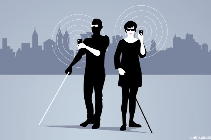
The navigator uses augmented reality, 3D sound, and high-precision GPS tracking to choose the best route.
A French startup called SonarVision has developed an app designed to help people with partial to full visual impairment move safely and choose the best routes to destination. The service, which is still being upgraded, is currently available in the capital Paris and surrounding area.
The SonarVision app was coded for the iOS platform and is therefore available for iPhone users only but the programmers – two young engineer students – promise to export it for the Android operational system as well.

The app, which is free to download, employs augmented reality, 3D sound, and high-precision GPS tracking to suggest the direction and the most practical route for users. To put it in simple words, blind users must walk the way the sound is coming from.
Users need a headset and an iPhone with the camera pointed at the road, or perhaps AR glasses for more convenience (and carry the phone in a pocket).
The app uses the phone’s camera to scan buildings using AR technology and compares them to Apple’s database of scanned buildings for a given city.
One important note is that the app isn’t a real-time obstacle detector and uses an existing technology called LiDAR, or “light detection and ranging”, to alert about what has already been mapped and stored on Apple servers.
Last year, SonarVision was available in the Paris Metropolitan Area – the capital and its suburbs – but other cities can be added too. The startup hopes to complete the Android version in 2024. And yes, it’s in French only.
More to read:
Apple overthrones Samsung as leading smartphone maker by volume
The project has earned the support of CentraleSupelec, a Paris-based startup incubator, which helps with testing, funding, entrepreneurial coaching, and aid from its vast network of researchers and alumni.
Currently, there are dozens of apps to aid visually impaired people, but SonarVision is the first to guide users by identifying the best itinerary and leading them from point A to point B.
While the two engineers guarantee a high precision tracking of large objects, small obstacles like a cardboard box or low stairs might be a problem. There’s also the risk of stumbling over people in a hurry.
So, carrying a cane to “touch” things and reveal your disability to people around you would be a good idea. Or better led a trained dog guide you.
***
If you want to buy us a cup of tea, please do it via PalPal: office[at]rudeana.com. Thanks.