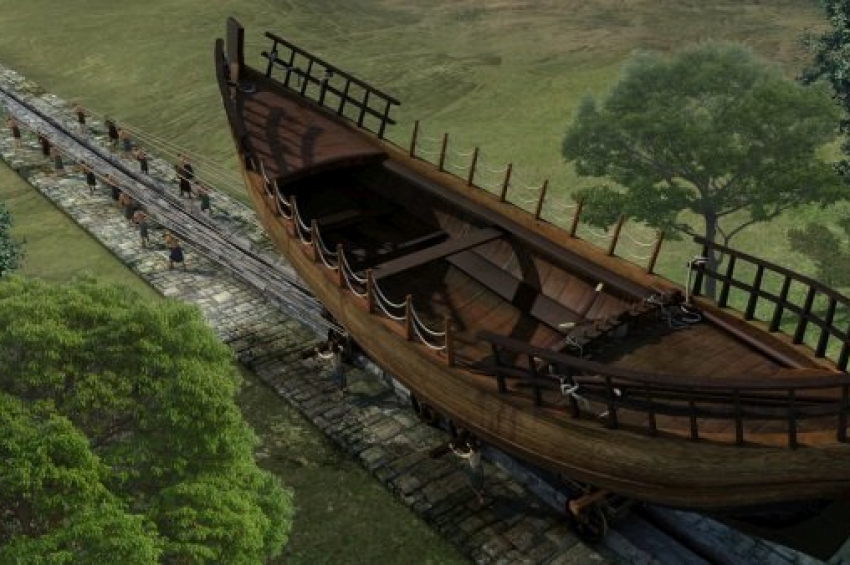
[animation] Ancient Greeks were first to build a railway
Corinth was a powerful city-state in the Ancient Greek world and controlled both maritime and land traffic between the northern and southern part of Greece, and played an important role in Greece’s trade with other countries. The city lies on the western part of a 6- to 13-kilometer-wide isthmus that is washed by the Gulf of Corinth on the west and the Saronic Gulf in the east.
The idea of a shortcut to spare travelers from having to sail all the way around the Peloponnese had been long considered by the Ancient Greeks, but they lacked technology and funding to dig a canal wide enough for boats.
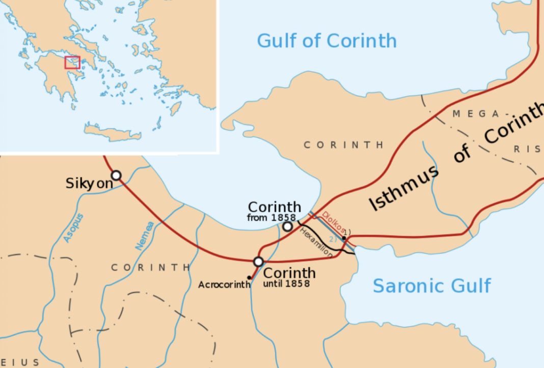
A map of the Corinth isthmus.
Around the year 600 B.C., Corinth tyrant Periander, a skillful administrator and warlord, ventured to capitalize on the city’s strategic location in order to gain economically. Connecting the two banks of the isthmus would have saved a lot of time and resources for merchants heading, for example, from the Ionian Sea to Athens, or for the military going from the Aegean Sea to Corfu. Normally they would have to circumvent the Peloponnese Peninsula via Cape Maleas, which was known for its strong winds and fast currents.
More to read:
Why did ancient Greeks compete naked at Olympic Games?
Therefore, Periander ordered the construction of a water canal across the isthmus. Soon after its start, he realized that the project was too expensive and technically challenging, and decided to abandon it. Instead, the ruler agreed to a proposal from his engineers to build a simpler stone ramp as a portage road.
The new stone road with grooved tracks, called Diolkos, was about 8 kilometers long, ranging from 4.5 to 6 meters in width, was constructed with a paving of porous limestone.
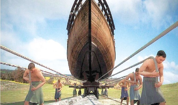
An artist's depiction of the process of vessel transportation on the Diolkos.
Upon reaching the coastal vicinity through the Gulf of Corinth, vessels were transported across a slanting stone-paved jetty. The western extremity of this jetty was likely submerged, and the ships were maneuvered over it on wooden rollers before being lifted onto a wheeled conveyance. Numerous wagons, laden with hefty cargo such as timber or marble, were then drawn by animals.
More to read:
Polynesians sailed to South America long before European colonists
Some stone blocks originated from abandoned monuments, and remnants of archaic Greek letters were still discernible. Unfortunately, no remnants exist of the eastern segment, and the precise endpoint remains unknown.
The Diolkos served for two major purposes: commercial and military. It was used to transfer goods and supplies from one gulf to another avoiding the navigation via Cape Maleas. Olive oil, wine, grains, animals, textiles, pottery, metalwork, weapons, wood, and other commodities found their buyers quicker thanks for the road.
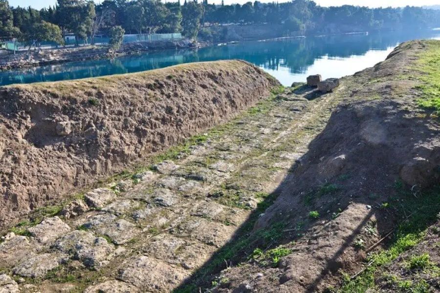
The western point of the Diolkos today.
During warfare times, Spartans, Pharossans, Macedonians, and Athenians – all chose to shortcut troops deployment using the Corinth stone road, according to written records left by ancient Greek historians. After his victory at Actium in 31 B.C., Roman commander Octavian advanced as fast as possible against Marc Antony by ordering part of his 260 Liburnians to be carried by over the isthmus.
In 67 A.D., Roman Emperor Nero attempted to build a water canal between the Corinth’s two ports using slaves, but never finished the project.
Discovery of the Diolkos
It was only in 1882 when construction of a modern Corinth Canal started, an effort completed by 1893. The ancient railways stayed forgotten until the late 1950s, when archaeologist Nikolaos Verdelis excavated parts of the Diolkos and dated it to around 600 B.C. during the reign of Periander, the second tyrant of the Cypselid dynasty.
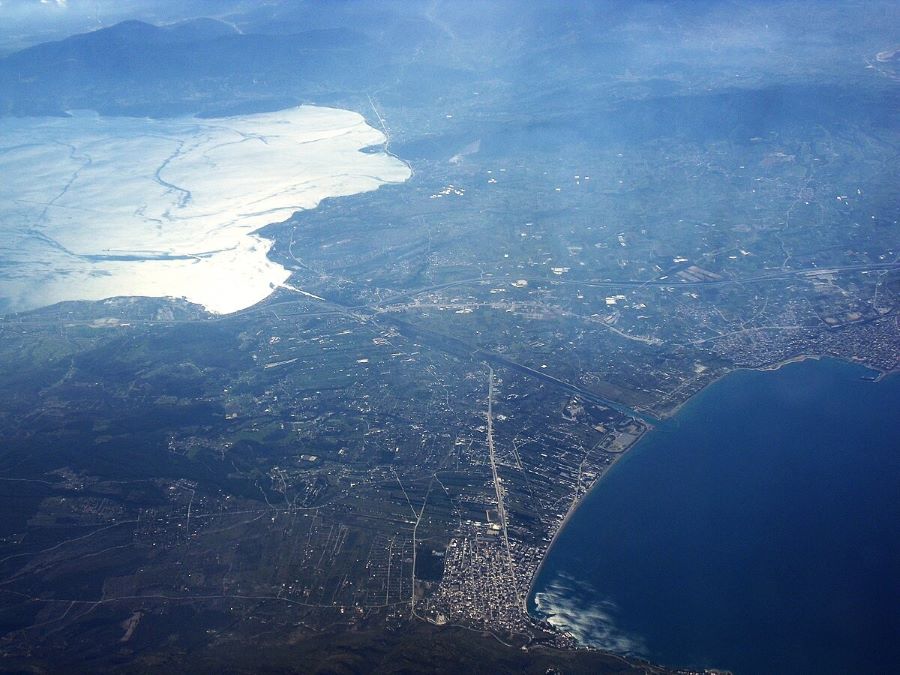
The Corinth isthmus as seen from space nowadays.
The Diolkos was part of a larger road network meant to move people, ships, and cargo. Other rails existed in the ancient world, but they had a singular purpose, such as moving stone out of a quarry to a staging area, and so aren't considered a true precursor to modern railroads.
Today Diolkos is considered the first permanent railways in recorded history. It was last used in the year 150 A.D. It is a historical monument under the protection of the Greek government.
A Greek educational website called Demetri posted an excellent animation in English on YouTube, for visual effects.
Sources: Historyofrailroad.com, History.com, Wikipedia 1, Wikipedia 2, Wikipedia 3, Greekreporter, Indie88.com
***
NewsCafe is a small, independent outlet that cares about big issues. Our sources of income amount to ads and donations from readers. You can buy us a coffee via PayPal: office[at]rudeana.com.

